Curaçao
From useless island to hub of the West Indies trade

Isla Inútil, Useless Island
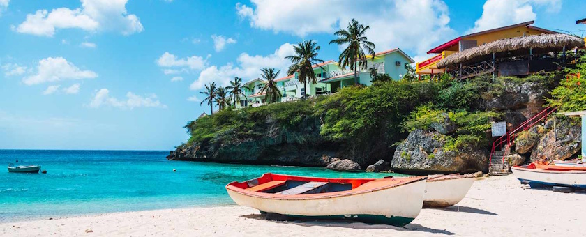
Curaçao lies in the southern Caribbean Sea, just above Venezuela. The island is thirty-seven miles long, narrow, and dry, making it slightly smaller than a third of the Dutch province of Utrecht. The landscape is rough and sandy, filled with low bushes, cacti, and the iconic divi-divi trees that all bend in the same direction because of the strong trade winds. Rain is rare and usually falls in short, heavy showers. Drinking water was always scarce and essential for survival. The northeast coast is harsh and rocky, but the south side features sheltered bays. One of these, St. Anna Bay, connected to the Schottegat, gave the island its greatest asset: a natural harbor that invited trade.
The first European to visit Curaçao was the Spaniard Alonso de Ojeda in 1499. The Spaniards settled in 1527, but quickly became disappointed. The soil was dry, farming was impossible, and salt harvesting was limited. Simply put, there was little money to be made. They brought along some livestock, including goats, cattle, and pigs, and left it at that. Curaçao received the label "isla inútil," or useless island. Hardly any settlements were built, and the island remained sleepy and quiet.
The Dutch West India Company and Slavery
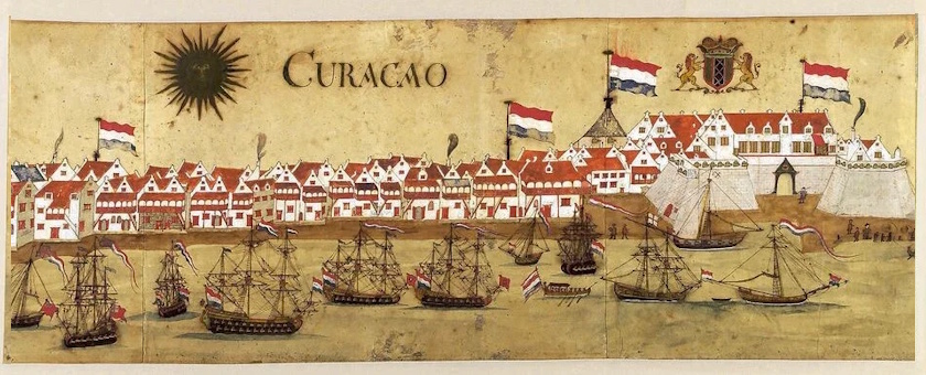
In 1634, the Dutch West India Company (WIC) captured the island. The Company, which traded in sugar, tobacco, and human beings, needed a base for trade and for attacking Spanish ships. Curaçao was in a perfect spot: close to the South American coast, with a safe harbor. The Spanish occupiers surrendered quickly. A small number of Indigenous families were allowed to stay, while the rest were sent to Venezuela. The Dutch immediately began building forts: first a small fort near the water spring, and later Fort Amsterdam near the harbor. Even so, the WIC directors in Amsterdam initially doubted the island's value. Running the military presence was expensive, and the returns were small. It was only when they discovered that Curaçao was ideally located for trade and slave transports that their view changed. The "useless island" suddenly became very valuable.
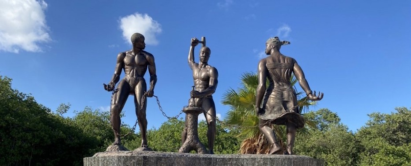
Starting in 1636, the WIC brought captured Africans to Curaçao. In 1637, the Company captured Fort Elmina on the West African coast, which grew into the main starting point for the slave trade. From there, thousands of people were shipped as slaves to Curaçao, and many were sent on to Spanish colonies. In this way, the island became the central hub for the human slave trade. Between 1621 and 1730, the WIC transported an estimated 273,000 enslaved people, with more than 100,000 passing through Curaçao. On the northeast side of the Schottegat, where the former Isla refinery sits today, once stood the large WIC slave camp, a place that stands as a symbol of human suffering and economic power. There, people who survived the ocean journey were given a few weeks to recover before being sold again. The trade in human lives generated millions in profit, turning Curaçao into the nerve center of the Dutch West India Company.
Besides the slaves, Sephardic Jews also came to the island. They had fled from Brazil, where they were not welcome under Catholic Portuguese rule. They settled on the north side of the Schottegat, in an area that later became known as the Jewish Quarter. Thanks to their international contacts, they played an important role in trade and smuggling. In this way, Curaçao grew into a major trading hub, with just as much smuggling going on as official trade. The WIC also encouraged European settlers to start farming. They were given land and livestock, on the condition that they grew crops for themselves and their workers, and sold any leftover food to the Company. In theory, they were supposed to help feed the island. In practice, it was mostly about basic survival. The soil was poor and the rainfall was unpredictable, but the number of plantations grew anyway. Farmers grew sorghum, which was the main food for enslaved people, and raised livestock.
There were two main groups of enslaved people: trade slaves, who were held for resale, and house or field slaves, who had to work on Curaçao itself. Around the year 1700, about 600 to 700 people worked on local plantations, while 1,800 worked as craftspeople or servants. The WIC itself owned more than 700 enslaved people. The work was hard, repetitive, and depended on the seasons. People planted and weeded during the rainy season, and harvested afterward. Led by bombas, who were overseers that were also enslaved, everyone worked in the heat, both men and women. Life was brutal, with no hope for a better future.
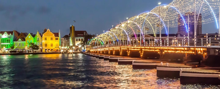
Meanwhile, a new settlement grew near Fort Amsterdam: Punda. Trade brought ships, warehouses, shops, and houses built in neat rows. Punda quickly became the beating heart of the island. Around 1680, the harbor was strengthened with walls and fortresses. A heavy chain stretched across St. Anna Bay kept enemy ships out. The combination of Fort Amsterdam and Punda made Curaçao almost impossible to capture.
The name Willemstad appeared around 1675, most likely named after William III, the Prince of Orange. In that same year, the island was declared a free port to boost trade even further. The city became a mixing pot of languages, cultures, and interests. Traders, soldiers, slaves, freed people, Jews, and Dutch settlers lived close together, driven by profit and necessity.
In this way, Curaçao transformed from a so-called "useless island" into one of the most important trading centers in the Caribbean, an island with a rich, but heavy history.
Post-war Development
During the Second World War, Curaçao once again found itself at the center of world history. This time, it was not because of the slave trade or piracy, but because of oil. The Isla refinery in Willemstad processed crude oil from Venezuela into fuel for planes, ships, and tanks – fuel that proved crucial for the Allied military. Because the island was so important strategically, the Americans came to help defend it. They built military bases, set up anti-aircraft weapons, and patrolled the coast with ships. German submarines lurked in the area and regularly torpedoed oil tankers, but Curaçao itself never became a battlefield.
After the Second World War, Curaçao slowly changed from an industrial center into a tourist destination. The oil refineries became less important for the economy, forcing the island to look for new ways to make money. Tourism provided the answer. To attract visitors, the island invested in better facilities. Hato Airport, which opened in 1942, played a key role: it made Curaçao easy to reach for travelers from overseas and opened the island up to a wider audience.
The rise of tourism on the neighboring island of Aruba created competition. Curaçao had to stand out and focused on its own unique identity: the colorful buildings of Willemstad, its rich history, its Caribbean culture, and the natural beauty of the island. Starting in the 1960s and 1970s, tourism really took off. Large groups of tourists from North America and Europe brought a steady stream of visitors who were curious about the sun, sea, and tropical vibe. In this way, Curaçao changed from an island living off oil to a destination offering charm, culture, and sunshine – a new chapter in its long and varied history.
After the 1954 Charter, Curaçao gained a lot of political power within the Netherlands Antilles. In theory, this should have helped the island build up decades of experience in governing itself. However, neighboring Aruba often felt left behind and asked for more independence, which it received in 1986 as a Special Status. Since October 10, 2010 (10-10-10), Curaçao, along with Sint Maarten, has been an independent country within the Kingdom of the Netherlands. Still, real life shows that all those years of political experience were not always used to their full potential, while the call for equality and true independence remains important today.