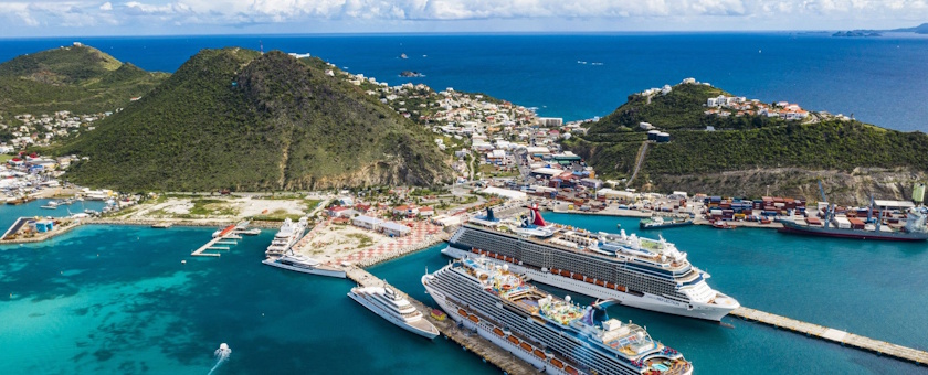
Sint Maarten
An Island with Two Faces

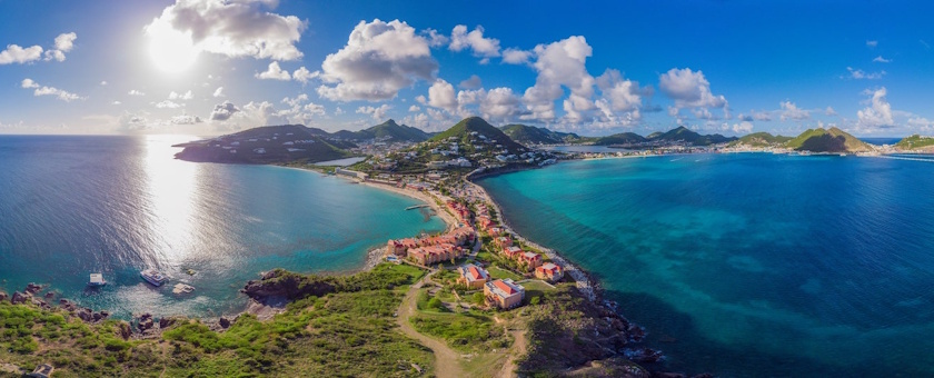
Sint Maarten – Land of salt and brave, beautiful women
Long before the first European ships sailed the Caribbean Sea, people were already living on Sint Maarten.
Archaeologists have found traces of settlements dating back as far as 3000 BC. The first inhabitants arrived by sea in hollowed-out tree trunks, likely coming from the area of present-day Venezuela and the Orinoco Delta.
They settled in places with plenty of fish, fertile soil, and shelter: near Hope Estate, Friar's Bay, and on small offshore islands.
These Indigenous peoples lived in harmony with nature. They grew cassava, corn, and beans, hunted small animals, and caught fish in the lagoon. They called their island Soualiga, which means "land of salt," because of the many salt lakes they used for drying fish. Another name was Oualichi, meaning "land of brave and beautiful women." Life was simple, but rich in tradition and cooperation.
The Arrival of Columbus and the Europeans
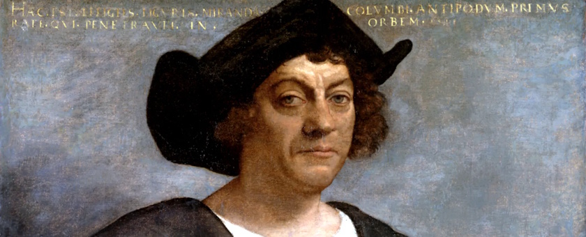
In 1493, Christopher Columbus sailed past the island during his second voyage to the New World. It was November 11, the feast day of Saint Martin.
Out of respect for that day, Columbus named the island San Martín, or Sint Maarten.
However, he never actually set foot on land; that only happened decades later.
In the century that followed, several European powers grew interested in the Caribbean. This was not because they saw beautiful beaches, but because they believed they could get rich from sugar, salt, and trade. The Spaniards were the first to claim power, but the Dutch, French, and English quickly followed. Sint Maarten's salt was especially important: in the 16th century, the Dutch lost access to Portuguese salt mines due to their war with Spain. Because of this, they went looking for new sources.
The Battle for the Island
In 1631, the Dutch built their first small settlement on Sint Maarten to gather salt.
A small French community was already living on the island at that time.
The Spaniards saw this as a threat and recaptured the island a few years later.
In 1644, Peter Stuyvesant, who was then the governor of Curaçao working for the Dutch West India Company (WIC), led a military attempt to bring Sint Maarten back under Dutch control.
However, he did not succeed.
During this attack, he was badly wounded by a cannonball, and his right leg had to be amputated.
He received a wooden leg, which later became his famous trademark when he became the governor of New Amsterdam, present-day New York.
The Spaniards held onto Sint Maarten until 1648, but they left the island that same year. The Dutch and French then returned, not to fight, but to find a solution together.
On March 23, 1648, they signed the Treaty of Concordia, agreeing to divide the island peacefully.
The French received the northern part, and the Dutch got the southern part.
According to local legend, a Frenchman and a Dutchman each started walking from a different point along the coast, and the border was set where they met.
Since then, both groups of people have lived on one island with an open border and a shared history.
Slavery and the Sugar Era
In the centuries that followed, Sint Maarten turned into a colony full of plantations. African people were brought to the island as slaves to work in the sugar fields and salt pans.
Their lives were hard: they had to work long days under a burning sun, without freedom or rights.
The French abolished slavery in 1848, and the Dutch side followed fifteen years later, on July 1, 1863. That day is still remembered as Emancipation Day.
After the abolition of slavery, the sugar economy collapsed. Many plantations were abandoned, and the population had to look for other work.
Salt remained important for a while (around 1850, more than 330,000 barrels were produced per year), but that industry slowly disappeared in the 20th century as well.
In the early 20th century, life on Sint Maarten was quiet, almost peaceful. There was little work, little trade, and many people left for other islands or the United States. In 1914, only about three thousand people lived on the island. During the First World War, Sint Maarten became isolated, as sea trade came to a stop.
The Second World War and the Arrival of the Americans
The Second World War (1939–1945) changed that. The Caribbean seas were threatened by German submarines, the famous U-boats, which attacked Allied ships.
The United States wanted to defend the region better, so they built military airfields on several islands.
In 1943, the Americans began building a runway at Simpson Bay.
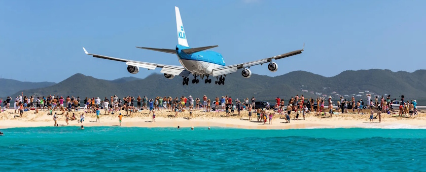
That became the foundation for what would later become Princess Juliana International Airport. At first, the airport served as a strategic base to hunt for German submarines, but after the war, it proved to be invaluable for the future of Sint Maarten.
Thanks to the airport, the island could open itself up to the world.
The war also brought more contact with the United States. American goods, music, and habits found their way to the population.
In this way, a new era slowly began: one of trade, travel, and later, tourism.
The Rise of Tourism
Starting in the 1950s and 1960s, more and more travelers from North America discovered the charm of the Caribbean.
Sint Maarten had something unique: two cultures, beautiful beaches, and, thanks to the airport, a direct connection to the outside world.
The Dutch side had already introduced tax-free status in 1939, making trade and tourism even more attractive. Around 1965, the island really started to grow.
Hotels popped up everywhere, shops filled up with luxury items, and the population doubled in a short period of time.
Where only a few thousand people used to live, Sint Maarten already had more than 40,000 residents in the 1980s.
Tourism became the main source of income.
The nickname "The Friendly Island" came about during this time, pointing to the warm and helpful attitude of the locals.
Disasters and Resilience
Economic growth also brought setbacks. In 1995, Hurricane Luis destroyed large parts of the island. Four years later, in 1999, Hurricane Lenny brought new damage.
Even so, Sint Maarten bounced back every time.
The population worked together, rebuilt hotels, schools, and houses, and welcomed tourists back with open arms.
The hardest blow came on September 6, 2017, when Hurricane Irma roared across the island with wind speeds of over 300 kilometers per hour.
Ninety percent of all buildings were damaged or destroyed. For days, there was no electricity or drinking water.
Yet the people of Sint Maarten did not give up. With help from the Kingdom, the European Union, and especially their own strength, they started over once again.
10-10-10 and the New Sint Maarten
An important milestone in modern history was October 10, 2010. On that day, the Netherlands Antilles ceased to exist.
Sint Maarten became an independent country within the Kingdom of the Netherlands, with its own government and parliament.
King Willem-Alexander remained the head of state.
With a size of only 34 square kilometers and around 40,000 residents, Sint Maarten is one of the smallest countries in the world, but it has a rich history.
From the Indigenous people of Soualiga, through the wooden leg of Peter Stuyvesant and the American planes of World War II, to the rebuilding after Hurricane Irma, the island has adapted and reinvented itself time and time again.
Today, Sint Maarten is still "The Friendly Island," a place where people from more than a hundred countries live together, where two cultures meet, and where the spirit of strength and teamwork is stronger than ever.